
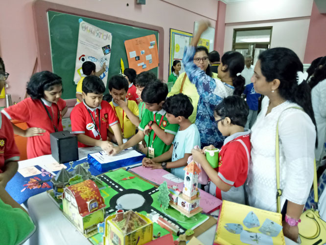
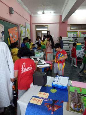
On the 15th August 2017, an exhibition was held in Dr. Pillai Global Academy, New Panvel.
Different exhibits were put up by the different departments in the school.
These included charts, models and project work done by the students from 5th to 12th standards. Parents and grandparents were invited to visit the exhibition and give feedback related to the work done by the students.
The Social Science Department had also put up a great show. The topic was ‘Use of Technology in Education’.
Several sub – topics were taken up as part of the exhibition and models and charts were prepared on these.


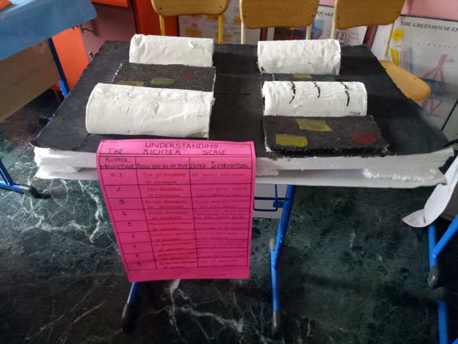
RICHTER SCALE
It was invented in 1935 by Charles F. Richter of the California Institute of Technology as a mathematical device to compare the size of earthquakes. The Richter scale is used to rate the magnitude of an earthquake, that is the amount of energy released during an earthquake.
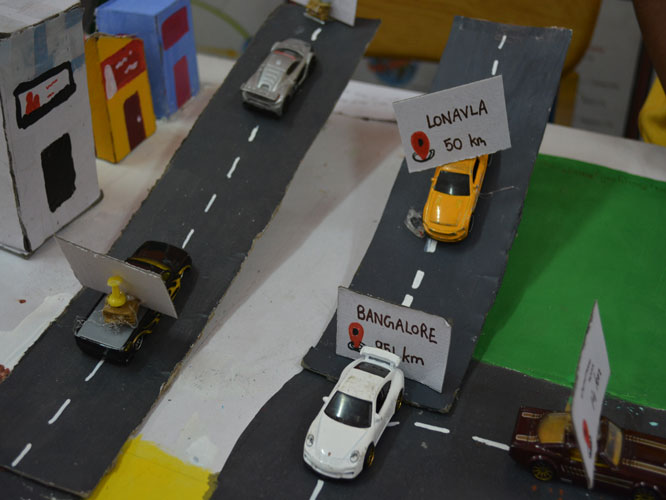
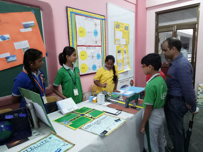
GPS
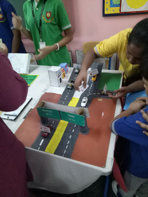
GPS technology became a reality through the efforts of the American military, which established a satellite-based navigation system consisting of a network of 24 satellites orbiting the earth. GPS is also known as the NAVSTAR (Navigation System for Timing and Ranging).
GPS works all across the world and in all weather conditions, thus helping users track locations, objects, and even individuals! GPS technology can be used by any person if they have a GPS receiver.
Applications
- Navigation – Used by navigators for orientation and precise velocity measurements.
- Geotagging – Map overlays can be created by applying location coordinates photographs and other kind of documents.
- Surveying – Surveyors create maps and verify the boundaries of the property.
- Map-making – Used by civilians and military cartographers.
- Tectonics – Detect the direct false motion measurement in earthquakes.
- Geofencing – Vehicle, person or pet can be detected by using GPS vehicle tracking system, person tracking systems, and pet tracking systems.
WEATHER INSTRUMENTS
A weather station is a facility, either on land or sea, with instruments and equipment for measuring atmospheric conditions to provide information for weather forecasts and to study the weather and climate. The measurements taken include temperature, atmospheric pressure, humidity, wind speed, wind direction, and precipitation amounts. Wind measurements are taken with as few other obstructions as possible, while temperature and humidity measurements are kept free from direct solar radiation, or isolation. Manual observations are taken at least once daily, while automated measurements are taken at least once an hour. Weather conditions out at sea are taken by ships and buoys, which measure slightly different meteorological quantities such as sea surface temperature (SST), wave height, and wave period. Drifting weather buoys outnumber their moored versions by a significant amount.
Typical weather stations have the following instruments:
- Thermometer for measuring air and sea surface temperature
- Barometer for measuring atmospheric pressure
- Hygrometer for measuring humidity
- Anemometer for measuring wind speed
- Pyranometer for measuring solar radiation
- Rain gauge for measuring liquid precipitation over a set period of time.
SATELLITES
Satellites are usually semi-independent computer-controlled systems. Satellite subsystems attend many tasks, such as power generation, thermal control, telemetry, attitude control and orbit control.
Satellites are used for many purposes. Common types include military and civilian Earth observation satellites, communications satellites, navigation satellites, weather satellites, and space telescopes. Space stations and human spacecraft in orbit are also satellites. Satellite orbits vary greatly, depending on the purpose of the satellite, and are classified in a number of ways. Well-known (overlapping) classes include low Earth orbit, polar orbit, and geostationary orbit.
 ELECTRONIC VOTING MACHINE
Electronic voting (also known as e-voting or EVM) refers to voting using electronic means to either aid or take care of the chores of casting and counting votes. Depending on the particular implementation, e-voting may use standalone electronic machines (also called EVM) or computers connected to the internet.


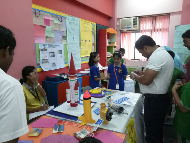
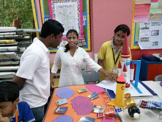
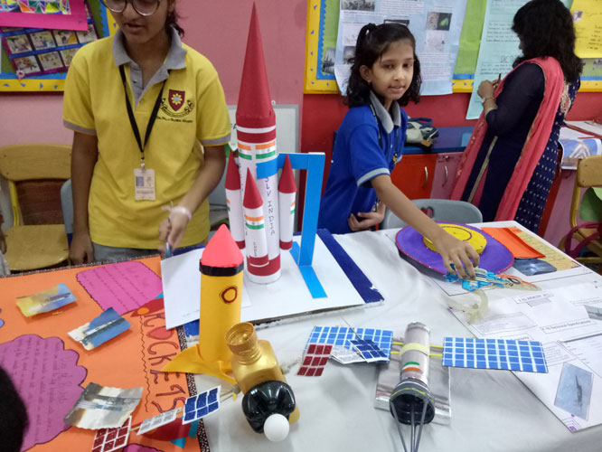
ROCKETS
A rocket (from Italian brochette “bobbin”) is a missile, spacecraft, aircraft or other vehicle that obtains thrust from a rocket engine. Rocket engine exhaust is formed entirely from propellant carried within the rocket before use. Rocket engines work by action and reaction and push rockets forward simply by expelling their exhaust in the opposite direction at high speed, and can therefore work in the vacuum of space.
Uses:
Military
Some military weapons use rockets to propel warheads to their targets. A rocket and its payload together are generally referred to as a missile when the weapon has a guidance system or as a rocket if it is unguided. Anti-tank and anti-aircraft missiles use rocket engines to engage targets at high speed at a range of several miles.
Science and research
Rocket engines are also used to propel rocket sleds along a rail at extremely high speed.
Spaceflight
Rescue
Rockets were used to propel a line to a stricken ship so that a Breeches buoy can be used to rescue those on board. Rockets are also used to launch emergency flares.
UFO
An unidentified flying object, or UFO, is in its strictest definition any apparent object in the sky that is not identifiable as a known object or phenomenon. However the term is widely used in popular culture to refer more specifically to supposed observations of craft of extraterrestrial origin.
Most UFOs are later identified as conventional objects or phenomena (e.g., aircraft, weather balloons, clouds). Some of them are not identified, either because of lack of evidence or because no conventional explanation can be found despite extensive evidence. Some people consider the latter cases as possible observations of extraterrestrial space craft.

AERIAL PHOTOGRAPHY
Aerial photography is the taking of photographs of the ground from an elevated/direct-down position. Usually the camera is not supported by a ground-based structure. Platforms for aerial photography include fixed-wing aircraft, helicopters, unmanned aerial vehicles (UAVs or “drones”), balloons, blimps and dirigibles, rockets, pigeons, kites, parachutes, stand-alone telescoping and vehicle-mounted poles. Mounted cameras may be triggered remotely or automatically; hand-held photographs may be taken by a photographer.
Aerial photography should not be confused with air-to-air photography, where one or more aircraft are used as chase planes that “chase” and photograph other aircraft in flight.
TIDAL POWER
Tidal power or tidal energy is a form of hydropower that converts the energy obtained from tides into useful forms of power, mainly electricity. Although not yet widely used, tidal energy has potential for future electricity generation. Tides are more predictable than the wind and the sun.
SOLAR ENERGY
Solar panels absorb the sunlight as a source of energy to generate electricity or heat. A photovoltaic (PV) module is a packaged; connect assembly of typically 6×10 photovoltaic solar cells. The most common application of solar panels is solar water heating systems.


DIRECTIONS
A compass is used to show directions.
A compass is primarily divided into the four cardinal points—north, south, east, and west. These are often further subdivided by the addition of the four intercardinal (or ordinal) directions—northeast (NE) between north and east, southeast (SE), southwest (SW), and northwest (NW) – to indicate the eight principal winds. In meteorological usage, further intermediate points between cardinal and ordinal points, such as north-northeast (NNE) between north and northeast, are added to give the sixteen points of a wind compass. At the most complete division in European tradition, are the full thirty-two points of the mariner’s compass, which adds points such as north by east (NbE) between north and north-northeast, and northeast by north (NEbN) between north-northeast and northeast.


COMMUNICATION DEVICES
The best example of a communication device is a computer Modem, which is capable of sending and receiving a signal to allow computers to talk to other computers over the telephone. Other examples of communication devices include a network interface card (NIC), Wi-Fi devices, and an access point.
Social media are computer-mediated technologies that facilitate the creation and sharing of information, ideas, career interests and other forms of expression via virtual communities and networks.
The term social media is usually used to describe social networking sites such as:
Facebook – an online social networking site that allows users to create their personal profiles, share photos and videos, and communicate with other users.
Twitter – an internet service that allows users to post “tweets” for their followers to see updates in real-time.
LinkedIn – a networking website for the business community that allows users to create professional profiles, post resumes, and communicate with other professionals and job-seekers.
Pinterest – an online community that allows users to display photos of items found on the web by “pinning” them and sharing ideas with others.
Snapchat – an app for mobile devices that allows users to send and share photos of them doing their daily activities.


People had come in large numbers to visit the exhibition. They were really impressed to see such magnificent work done by the students. Overall the exhibition was a grand success as the feedback given by the parents and grandparents were very positive and really lifted the spirits of the children to do such excellent work in the future also.


